About Atherton
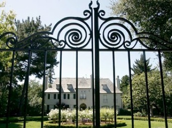
Atherton is located on the peninsula nestled between the San Francisco Bay and the Pacific Ocean. The Town begins in the flatlands then moves westward to the hills, until it reaches Highway 280. Beautiful foliage, elegant gardens and heritage trees dominate this quiet small community.
The Town of Atherton desires, insofar as possible, to preserve its character as a scenic, rural, thickly-wooded, residential area, with abundant open space with streets designed primarily as scenic routes rather than for speed of travel.
Demographics
Local Government
Atherton Town Hall
91 Ashfield Road
Atherton, CA 94027
650.688 6528
The Atherton Town Hall provides directions, public transit options and visitor brochures.
Population in July 2008: 7,406. Population change since 2000: +2.9%
Males: 3,581 (48.4%)
Females: 3,825 (51.6%)
Median resident age: 45.3 years
California median age: 33.3 years
Zip codes: 94027.
Estimated median household income in 2008: over $240,482 (it was over $200,000 in 2000)
Atherton: over $240,482
California: $61,021
Estimated per capita income in 2008: $138,582
Estimated median house or condo value in 2008: over $1,823,518 (it was over $1,000,000 in 2000)
Atherton: over $1,823,518
California: $467,000
Mean prices in 2008: All housing units: $2,227,583; Detached houses: $2,252,617; Townhouses or other attached units: $1,920,745; In 5-or-more-unit structures: $543,437
Recent home sales, real estate maps, and home value estimator for zip code 94027